
Discover how Ordnance Survey helps adventurers, hikers, and outdoor enthusiasts explore Great Britain with confidence through detailed maps, digital tools, and expert navigation tips in this complete guide to outdoor discovery.
Table of Contents
- What Is Ordnance Survey?
- Why Ordnance Survey Matters Today
- Understanding Ordnance Survey Maps
- Ordnance Survey and Outdoor Activities
- The Ordnance Survey App
- Famous Locations Mapped by Ordnance Survey
- How Ordnance Survey Promotes Outdoor Safety
- Ordnance Survey for Education and Research
- Digital Transformation of Ordnance Survey
- Benefits of Using Ordnance Survey Maps
- How to Read an Ordnance Survey Map Like a Pro
- Buying and Accessing Ordnance Survey Maps
- Environmental Impact and Sustainability
- The Future of Ordnance Survey
- Final Thoughts on Outdoor Discovery
- FAQs
What Is Ordnance Survey?
When you think about exploring the outdoors in the UK, one name stands out — Ordnance Survey. But what exactly is it?
Simply put, Ordnance Survey (OS) is Great Britain’s national mapping agency. It creates some of the most detailed and trusted maps in the world. Whether you’re hiking a mountain trail or planning a cycling route, OS maps are like your silent adventure partner.
The Origins of Ordnance Survey
It all started in 1791. Initially created for military defense purposes, Ordnance Survey was tasked with mapping the Scottish Highlands after the Jacobite rebellion. Over time, what began as a military necessity evolved into a public treasure.
Today, OS is a civilian organization focused on helping people navigate and understand the landscape.
The Mission Behind the Maps
The mission? Simple but powerful: map Britain better than anyone else.
Every road, hill, river, and footpath is carefully recorded. Think of it like building a detailed blueprint of the country — one contour line at a time.
Why Ordnance Survey Matters Today
You might wonder — in a world of Google Maps, do we still need paper maps?
Absolutely.
Supporting Hikers and Adventurers
For outdoor lovers, OS maps are gold. They show public footpaths, bridleways, terrain elevation, and even field boundaries. If you’re heading into remote areas, mobile signal might fail — but a paper OS map won’t.
Helping Businesses and Governments
OS data isn’t just for hikers. Businesses use it for urban planning, construction, transport networks, and environmental management. Accurate location data is the backbone of modern infrastructure.
Understanding Ordnance Survey Maps
Explorer Maps (1:25,000 Scale)
Explorer maps are perfect for walkers. At a 1:25,000 scale, every 4 cm on the map equals 1 km in real life. They show incredible detail — from walls to small streams.
Landranger Maps (1:50,000 Scale)
Landranger maps cover larger areas with slightly less detail. Ideal for longer trips or cycling routes.
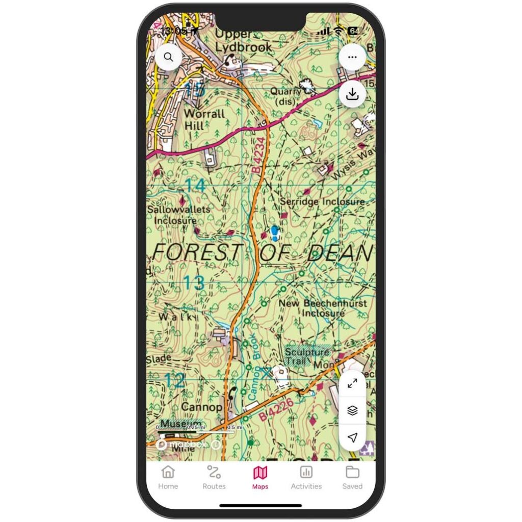
Symbols and Map Reading Basics
OS maps use symbols to represent features. A small green dashed line? That’s a footpath. Brown lines? Those are contour lines, showing elevation.
Learning these symbols is like learning a new language — but once you know it, the landscape starts speaking to you.
Ordnance Survey and Outdoor Activities
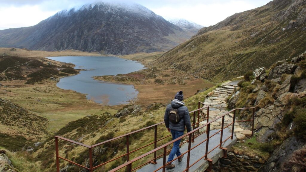
Hiking and Walking Trails
From gentle countryside walks to steep mountain climbs, OS maps guide your steps. Planning a trip to Lake District National Park? An Explorer map will show every trail.
Cycling and Mountain Biking
Prefer two wheels? OS maps highlight cycle routes and terrain types, helping you avoid unpleasant surprises like steep climbs.
Camping and Wild Adventures
Want to find campsites or remote spots? OS maps show facilities and terrain so you can plan smartly.
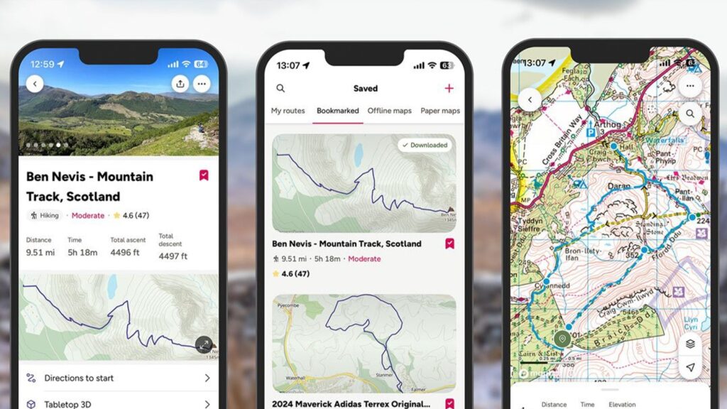
The Ordnance Survey App
Gone are the days of carrying only paper maps.
Key Features of the App
The OS Maps app offers:
- GPS tracking
- Route planning
- Offline downloads
- 3D terrain view
It’s like having a digital compass in your pocket.
Offline Maps and GPS Tracking
Heading somewhere remote? Download maps in advance. Even without signal, you’ll know exactly where you are.
Planning Routes Like a Pro
You can customize routes based on distance and difficulty. It’s perfect for beginners and seasoned hikers alike.
Famous Locations Mapped by Ordnance Survey
Snowdonia National Park
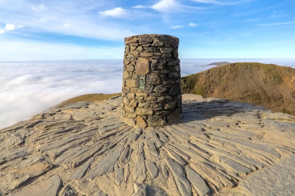
Exploring Snowdonia National Park? OS maps show every ridge and valley.
Peak District National Park
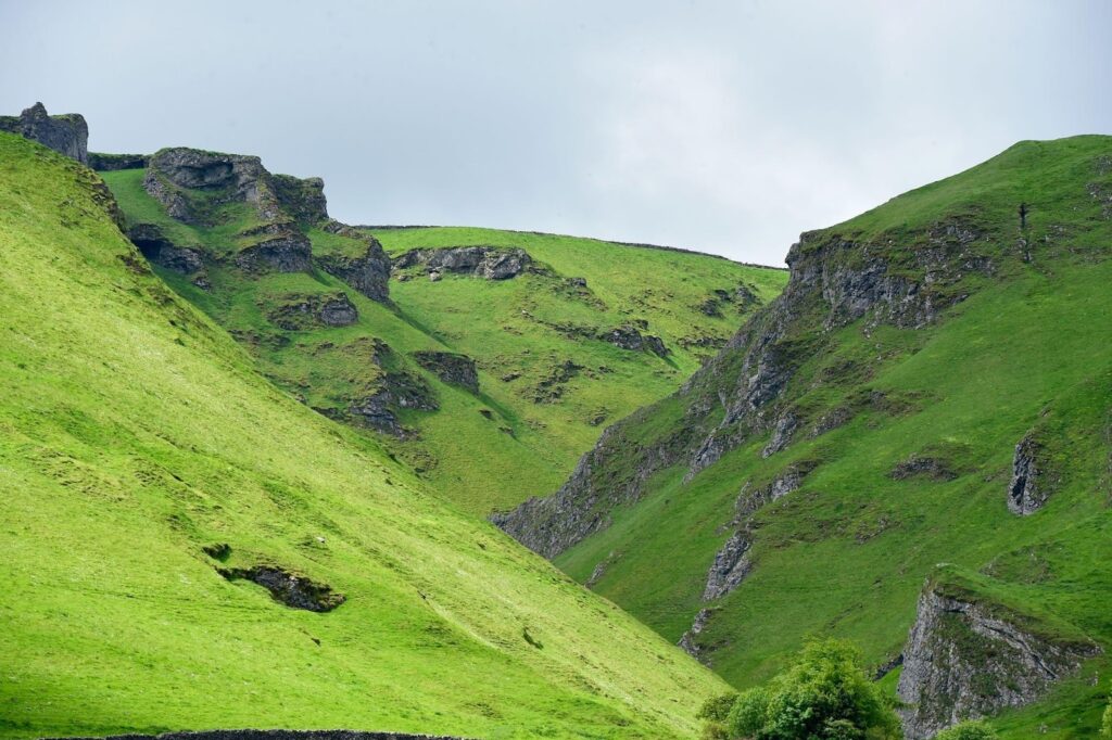
In Peak District National Park, accurate mapping is crucial due to changing weather and rugged terrain.
How Ordnance Survey Promotes Outdoor Safety
Grid References Explained
OS maps use a National Grid system. This allows precise location identification — vital in emergencies.
Emergency Navigation Tips
If lost:
- Stay calm.
- Check your grid reference.
- Contact emergency services with exact coordinates.
That little grid square could save your life.
Ordnance Survey for Education and Research
Schools use OS maps to teach geography. Universities rely on OS data for Geographic Information Systems (GIS). It’s not just adventure — it’s education.
Digital Transformation of Ordnance Survey
From paper to pixels, OS has evolved.
From Paper to Digital
Digital mapping has expanded possibilities. Developers use OS data in apps, navigation systems, and smart city projects.
OS Data Hub
The OS Data Hub provides APIs and datasets for businesses and developers. It’s location intelligence at scale.
Latest Post


Benefits of Using Ordnance Survey Maps
Accuracy and Reliability
OS maps are known for precision. Every detail is verified and updated regularly.
Encouraging Exploration
Maps don’t just guide — they inspire. Seeing a trail on paper makes you want to explore it.
How to Read an Ordnance Survey Map Like a Pro
Contour Lines
Closer lines mean steeper slopes. Wide gaps? Gentle hills.
Map Legend and Symbols
Always check the legend. It’s your decoding tool.
Read More:-
Red Letter Days: Your Ticket to Unforgettable Experiences
Enhance Your Videos with Movavi (US): A Comprehensive Review
The Hussle Advantage: Elevate Your Performance
Raileasy: Making Train Trips Effortless and Affordable
Elevate Your Website Performance with Dogado DE
Buying and Accessing Ordnance Survey Maps
You can purchase paper maps online or subscribe to OS Maps for full digital access. A subscription gives access to every OS map in Great Britain.
Environmental Impact and Sustainability
OS promotes responsible exploration. By clearly marking public paths, they help protect private land and sensitive ecosystems.
The Future of Ordnance Survey
The future is smart mapping — real-time updates, AI-powered terrain analysis, and deeper digital integration.
Mapping is no longer static. It’s alive.
Final Thoughts on Outdoor Discovery
Adventure starts with curiosity — but it thrives on preparation.
Ordnance Survey isn’t just a mapping agency. It’s a gateway to discovery. Whether you’re climbing mountains, cycling valleys, or simply walking through countryside trails, OS maps give you confidence.
Think of them as your compass in a world full of paths.
And honestly — isn’t exploration better when you know exactly where you stand?
FAQs
Q. What is Ordnance Survey used for?
A. It’s used for navigation, outdoor activities, business planning, and geographic research across Great Britain.
Q. Are Ordnance Survey maps better than Google Maps for hiking?
A. Yes, for outdoor navigation. OS maps show footpaths, terrain, and elevation details that standard digital maps often miss.
Q. Can I use Ordnance Survey maps offline?
A. Yes. Both paper maps and offline downloads via the OS Maps app work without internet access.
Q. What scale is best for walking?
A. The 1:25,000 Explorer maps are best for detailed walking routes.
Q. Is Ordnance Survey only for the UK?
A. Yes, it primarily covers Great Britain.